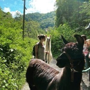
Take a Hike
The Lodge is located adjacent to the Appalachian Trail at the base of Deer Park Mountain. There are a number of hikes you can begin from the Lodge. Lover’s Leap Trail is the most popular with the walk along the French Broad River and can be viewed from the upstairs guest rooms. It includes hiking up the mountain’s edge with switchbacks taking you to great views of the river and valley. You may also want to consider the Pump Gap Trail, the Laurel River Trail and Betty Place, and some of our other favorites listed by difficulty below.
Easy
Laurel River Trail
This hike goes along the Laurel River, following an old railroad grade to the remains of the town of Runion near the French Broad River. This one is a short drive away. From the Lodge, drive down to Bridge Street (Hwy 25-70) and turn left. Go over the mountain and turn right at the Steady Eddy (this is the coffee shop on the right at yield sign) There is a dirt parking area almost immediately to the right. The trailhead is at the far end of that parking area, marked by a small sign. This pleasant walking trail runs along the Laurel River downstream towards the French Broad River. The entire trail is about 4 miles long–dead ending at the railroad tracks and the French Broad River. The terrain is sometimes rocky, and basically level. There are huge boulders in the river where you may sit or picnic, and also swimming holes. If you enjoy water, you will love this hike! Rhododendron shades the trail and a variety of native wildflowers such as trillium, bloodroot, jack-in-the-pulpit, and rattlesnake plantain, thrive in this shady, moist environment. But be careful of the poison ivy which also grows well along the trail. The trail is not a loop! You just turn around and return the same way you went, but there is much to see. You may get to watch kayakers paddling. Also mountain bikers use this trail. Hiking and travel time: this depends on how far out you walk, but we suggest planning on at least 2 hours.
Easy to Moderate
Max Patch
The Appalachian Trail crosses Max Patch at its 4,629′ summit and offers 360 degree views of NC and TN on clear days. It is a big spacious bald about 45-minute’s drive from Hot Springs. To get there follow Rte 209 out of town, with the Smokey Mountain Diner on your right. Drive 15-20 minutes on very windy roads and turn right onto Meadowfork Rd., following the signs to Max Patch. You will be driving for a long time on windy, dirt roads climbing all the while in elevation. Max Patch is best to visit on a clear day. Dress warmly and take extra clothes along that you don’t expect to need, because you probably will want them! The altitude difference makes it quite a bit cooler and windier up there. And take sunscreen and a hat if you are going on a sunny day. Park in the parking area and hike up to the summit of the bald. This may take about 15 minutes. In addition, you may want to hike around up there on the Appalachian Trail a while. Max Patch is everyone’s favorite picnic spot! Driving time: 1.5 hours, hiking time depends on you.
Moderate
Betty Place Trail
This hike is a loop on a spectacular north-facing slope of Bluff Mountain. Drive out 25/70 N (towards Newport,TN) about 3 miles to Upper Shut-In Road and turn left. Go 5 miles and turn left at the sign directing you to the trailhead just before main Shut-In Road bends to the right and crosses Shut-In Creek. Beginning just south of the parking area and to the right of the information kiosk, the trail enters the woods and forks. Taking the right fork, cross footbridge over West Fork of Shut-In Creek. The trail turns to the left along creek up an old roadbed, then switchbacks head uphill past remains of an old homesite on left. At old skid road, trail bears left for a long grade uphill past old chestnut stumps, with cove forest and boulder ravine on left and upland forests on right. A little later the trail passes through rhododendrons, large hemlocks and towering hardwoods. Towards the end of the trail, lower portions were used back in 1998 to skid timber from a thinning area to the right of the trail as part of a timber sale by the Forest Service. Trail concludes with a turn to the left back towards the creek and entrance trail. 1.2 miles; Hiking time: 45 minutes-1 hour; Drive to trailhead: 15-20 minutes.
River Ridge Loop at Murray Branch
You will see spectacular views of the French Broad River on this hike. It is just a short drive away. From the Lodge, drive over the French Broad River and take an immediate left and then a right onto River Road. Go about 3 miles and the road will turn to gravel and will narrow. Continue about 1 mile and park at the Murray Branch Picnic Area. The trailhead is directly opposite the first paved entrance. You have to look carefully to see the sign! This trail is a loop and the footing is mostly packed dirt with very few rocks. The grade is gradual. In October 2002, a wildfire passed through this area on the East side of the French Broad River, burning thousands of acres before it was brought under control. You will notice the charred ground, tree trunks, and many dead and dying pine trees. There is also plenty of new life each Spring to witness along this trail, including Firepinks, Spring Beauties, and new pine and oak seedlings. After about 5-10 minutes walking, follow the trail to the right. It then soon meanders along a ridgeline with magnificent views of the River and the fertile French Broad River Valley. This is a great time to stop for a picnic and soak up the view. Hiking and travel time: 1.25 hours.
Spring Creek Nature Trail
A loop following Spring Creek as it tumbles past boulders and sunny pools. Take Rte 209 to Rocky Bluff Campground, about 3 miles from Hot Springs on Rte 209. Turn left into the campground and park down in the picnic area. (If the gate is locked, park at the top and walk in.) There is a sign for Spring Creek Nature Trail on the lower road in the campground. Follow the trail downhill where it soon follows along the banks of the Creek. This is one of our favorite walks and offers ample boulders and sandy beaches to lounge and picnic on. The headwaters of Spring Creek are to be found up in Bluff, Max Patch and Meadowfork and these waters converge with the French Broad River in Hot Springs. The trail eventually climbs back up out of the gorge and back to the campground. 1.2 miles; Hiking and travel time: 1.5 hours
Difficult
Lover’s Leap
You may walk to the Lover’s Leap trailhead from the Lodge. You walk through Hot Springs on Bridge Street and over the French Broad River bridge, walking on the right side of the bridge. At the end of the bridge, step over the guardrail and go down the narrow footpath. When you reach the paved road, go left (upstream), over a wooden bridge , staying along the River for a few minutes. Then the trail heads up, with multiple switchbacks and two overlook rocks with a great view of the town and valley. The trail is quite rocky and uphill, but not very long. Along the river, just before the trails go uphill, you’ll enjoy virtual carpets of Bloodroot and Spring Beauties in March and April. Up towards the top there are wild blueberry bushes which usually fruit in July or August. At the top of the trail, which is Lover’s Leap, you can loop back down the other side. Here you will walk through dense forest with low-lying rhododendrons and mountain laurel along the trail. These usually are in bloom during May and June. You will end up looking down at Silvermine Campground. Turn left and stay on the wooded trail or follow the trail to the right and down to the campground. Either way, take a left onto the gravel road and back to the river, up the trail to the Bridge, etc. About 2 miles; Time from the Lodge and back is 1 hour to 1.5 hours.
Pump Gap Trail
This trail offers diversity: you’ll walk along a fast-flowing stream and dense forest part of the time, and then have lovely vistas to breathe in! Parts of this hike are very steep–we recommend hiking boots or shoes w/good ankle support. From the Lodge, drive over the French Broad River and immediately turn left and then left again (at the stop sign), driving under the bridge. Stay on this paved road (NOC is on the left), following the bend in the road to the left. Park at the trailhead. This area is called Silvermine and there is a map posted for your use. We recommend that to hike the Pump Gap Loop Trail, start off by walking around the Forest Service gate and up the little gravel road. Continue past Silvermine Group Campground, staying on this old road along the Creek and into the woods. There will be several creek crossing and when you come to a fork in the trail, go left. The Pump Gap trail is marked w/yellow blazes on trees. This is where it becomes steep for a while. Eventually this trail joins the Appalachian Trail (white blazes) for a short while. You will come to a rather primitive almost flat campsite area on your left and at this point the AT turns right and goes back to Hot Springs. Now, you keep going straight & down the hill (following yellow blazes). When you emerge from the woods onto a grassy old Forest Service Rd, go to the right and after a few yards your trail drops back down into the woods to the left again. You’ll meander along going downhill for a while, cross a steam and then climb back up. Again, you emerge from your little trail into an intersection with the Appalachian Trail. You will want to keep going straight and down. Believe it or not, you will find yourself (after about 30 minutes) back down at Silvermine and your car! Hiking Time: about 2.5-3 hours; 5.7 miles.